


On beings and biomes—the role of the river
By Madison Grosvenor
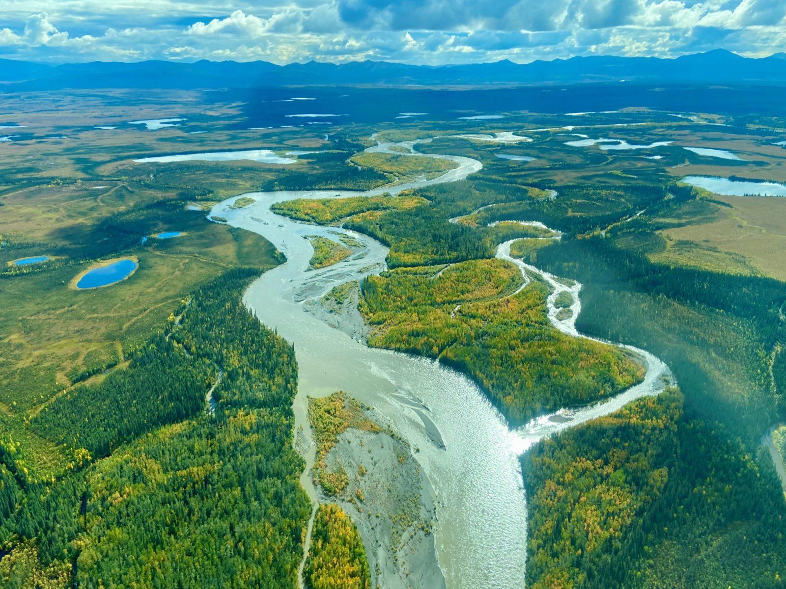
As seasons shift and ice gives way to current, Alaska’s waterways become arterial corridors of movement and change, drawing life back toward their banks.
From overhead the north fork of the Koyukuk River. Photo by Suzanne Bostrom.
Rivers slice through ancient stone, carrying glacial melt from icy peaks down to the sea. Within their currents we can read the story of the land itself: slow and patient in some places, wild and rapid in others. Always moving, always becoming.
Alaska has approximately 365,000 miles of river stretching from the coastline of the southeast to the north slope of the Arctic. From the braided channels of the Yukon to the rapids of the Susitna, these waters shape everything they touch.
Their movement is what makes Alaska’s lands so alive. These waterways carve valleys, feed forests, and guide the lives of those who live along their banks.
The headwaters
Every river has a beginning. In Alaska, these beginnings are shaped by towering mountains, receding glaciers, snowfields, and vast wetlands.
The headwaters of the Canning River, originating in the Brooks Range. Photo by Lisa Hupp.
The state’s hydrologic cycle drives the formation of its rivers through its continuous movement of water between the atmosphere, the land, and the ocean.
Water evaporates from lakes, rivers, soils, vegetation, and the ocean, rising into the atmosphere where it cools and condenses into clouds before returning to the Earth as rain or snow. Much of Alaska’s precipitation falls in mountains, stored seasonally as snow or as glacier ice for years, decades, centuries.
As temperatures rise, snow and ice release water that flows downhill. Small rivulets gather in shallow channels, joining to form small creeks and streams that merge into larger tributaries. With every confluence, rivers gather momentum, growing in size, strength, and power to shape the land.
Not all the water remains on the surface. Some water replenishes groundwater that seeps back into streams and rivers, sustaining their flow even in drier periods and over long winters.
As rivers continue their journey, they erode mountainsides, carve out valleys, reshape floodplains, and deposit sediments throughout soils and diverse habitats. From braided glacial channels, to the broad meandering rivers, these waterways eventually return their waters to the ocean. Yet this movement never ceases, the cycle begins again.
Milky rivers and storm surges
Ancient ice turns to moving water, as with the Susitna River, which begins as a glacial stream high up in the Alaska range. It’s milky blue hue, rich with sediment, flows from the Susitna glacier, all the way to Cook Inlet’s Knik Arm.
View of the Susitna River, originating from the Susitna Glacier in the Alaska Range. Photo by Jordan Oldenburg, BLM.
Glacial rivers are a defining feature of Alaska, forming slower moving, braided channels. Glaciers grind rock into fine sediment released by meltwater. Huge amounts of sand, silt, and gravel are pushed downstream. The sediment load then settles across the wide, shallow riverbeds, creating obstacles that split the water into multiple channels that weave and rejoin. The river is constantly redistributing its energy and reshaping the landscape.
Here, the river’s energy is devoted as much to moving earth as moving water. Because so much of its force is spent transporting sediment, the flow spreads across expansive floodplains rather than cutting a single deep channel, altering the entire landscape below the melting ice.
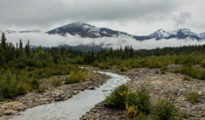
The Tanana river, fed by snowmelt. Photo by Diego Delso.
Alongside glacial rivers, snowmelt-fed rivers flow, fed by melting snowpack. The volume of these rivers fluctuates with the season, with levels topping out in late spring and early summer as the snow melts at the higher elevations. As the snowpack is depleted through the summer, river levels gradually decline, and many look much smaller by late summer and fall.
Here too, rivers become seasonal pulses of energy, carrying water, nutrients, and life downstream.
Rain-fed rivers are most common in coastal Alaska, where precipitation is higher.
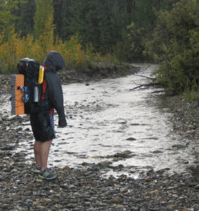
The Sushana river reforming during a hailstorm. Photo by Paxson Woelber.
These rivers respond very quickly to heavy rainfall, causing rapid increases in water levels and stronger currents during storm surges. When they depend solely on rainfall, their flow can decrease just as quickly in drier periods.
Rain-fed rivers and streams typically flow directly into the ocean and provide important habitat for fish and wildlife.
Together, these types of rivers combine and flow in countless ways to create Alaska’s incredible network of waterways, each contributing their own rhythm and energy to the living world to whom they’re woven.
The living edge
Along these ever-changing waterways lies the living edge.
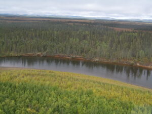
The lush riparian zone in the Yukon Delta National Wildlife Refuge. Photo by Fred Broerman.
The riparian zone is where land and water meet, and the river’s energy gives rise to one of Alaska’s most productive ecosystems. This ribbon of vegetation near the river’s edge, is where soil and plant life is shaped by water.
Deep-rooted plants stabilize streambanks, reducing erosion while providing shade that keeps water cool for fish. Leaves, twigs, and other organic material fall into the river as the foundation of the aquatic food web, feeding tiny invertebrates that nourish fish, birds, and other wildlife.
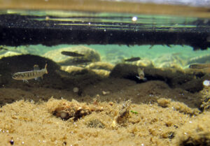
Juvenile salmon rest within the riparian zone of the Kenai River. Photo by Katina Mueller.
The riparian zone serves as a water filter, too, acting as a sponge by absorbing water from rain and snowmelt, and filtering and recycling sediment and excess nutrients that would otherwise enter the stream. This keeps the water clear and clean for fish to spawn.
As rivers reshape their channels, they carry fallen trees and branches downstream. This woody debris slows the current, forms eddies and side channels, and creates shaded shelter where young fish, insects, and countless other river dwellers can feed and grow.
The river’s energy doesn’t move water only upstream to downstream. Rivers continually build and renew the rich living edge where land and water come together.
From salmon to bears to trees
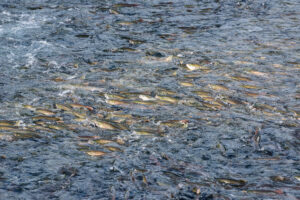
Salmon swim upstream in Brooks River. Photo by Russ Taylor.
Every year, the river senses fast silver bodies pushing against its steady current, returning from the sea with an urgency as ancient as the waterways themselves.
Salmon trace the familiar channels that first carried them toward the ocean. The river gathers them into its bends and ripples, lifts them over stones, and embraces them as they struggle upstream toward the gravel beds where they started. For a brief season, the river seems to flow in two directions at once.
Salmon aren’t the only ones on a journey of return. Bears amble down to the river to feed as well.
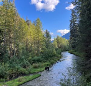
Bear eats salmon on the banks of the river in the Tongass. Photo by Ben Limle.
When bears catch salmon, they take their catch to the shoreline or deeper into forests to eat. Other river dwellers like eagles, gulls, martens, and ravens eat what bears leave behind and help to scatter fish remains along the riverbanks, while insects, fungi, and other river beings break down the rest.
What isn’t consumed decomposes and deposits nutrients like nitrogen and phosphorus into the soil. Then the roots of towering trees take them up. In time, the energy that once fueled a fish in the open ocean and up the river becomes part of a spruce needle, a wildflower, a berry bush, the next generation of forest life.
Some of Alaska’s most iconic coastal landscapes, like the Tongass National Forest, the Kenai Peninsula, and the Kodiak Archipelago, have been shaped by this dynamic relationship between salmon, bears, and forests.
Healthy rivers sustain life far beyond the water’s edge.
The people of the rivers
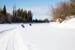
Traveling to a trap along a frozen river in the Yukon River National Wildlife Refuge. Photo by Lisa Hupp.
Long before roads carved their way across Alaska, rivers traced the paths of people’s daily lives. They carried families between villages, hunters to hunting grounds, food to the table, and provided fresh water from season to season.
Rivers have historically served as natural travel routes between remote areas of Alaska. In the summer, boats and canoes travel along rivers to reach neighboring communities, access hunting and fishing areas, and transport supplies.
During the winter, when rivers freeze solid, many waterways transform into ice roads that allow snowmachines and other vehicles to travel to places that would otherwise be difficult to reach.
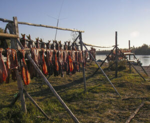
Subsistence fish drying racks along the Kobuk River. Photo by Seth McMillan.
Each summer, salmon runs bring millions of fish back to Alaska’s rivers, creating an important source of food for families across the state. Traditional fish camps draw people to the same places untold generations fished before. Many Alaskans spend many weeks fishing, processing, drying, smoking, and freezing salmon to store for the colder months ahead.
Beyond transportation and food, rivers supply fresh water for drinking and household needs, support wildlife that communities rely on for hunting, and offer places for recreation and gathering.
Rivers as living pathways shape how people travel, work, eat, and connect with their communities.
Warming oceans, rusting rivers, big bad roads
Alaska’s rivers act as the arteries and veins of living communities. They bring and sustain life.
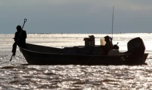
Dipnetting the lower Yukon River, Alaska. Photo by Katrina Liebich.
But a warming climate, growing industrial interest, and increasing pressure on freshwater resources are reshaping rivers in ways that ripple through entire cycles of life.
The Yukon River, once sustaining hundreds of thousands of salmon in its watershed, has experienced a long-term decline, forcing fishery closures for years along the Yukon.
A recent study links this decline to heat waves in the Bering Sea, stating that increasing marine heatwaves are accompanied by the deaths of older juvenile and adult Chinook—the very fish who would have returned to spawn. The loss of these spawning salmon results in a cascade of loss up and down the river. In some cases, riverine heatwaves follow suit, reducing water quality and harming the living beings who rely on the river as home and nourishment.
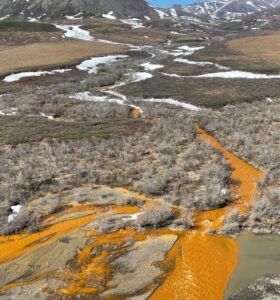
Alaska stream turning orange in Kobuk Valley. Photo by Josh Koch.
Rising temperatures reshape aquatic ecosystems across Alaska, altering everything from ocean conditions that sustain salmon to the very chemistry of inland rivers.
In the Arctic, some rivers have turned orange.
The Salmon River winds through Kobuk Valley National Park in northwest Alaska. In 1980, it was designated a national wild and scenic river for its remarkable clarity and abundant salmon. Today, stretches of this once-pristine river look rusty orange.
Scientists believe as permafrost thaws, sulfide-rich bedrock is exposed to oxygen and water, creating acidic conditions that dissolve metals and carry them into nearby rivers.
This isn’t just happening in the Salmon River. As more permafrost thaws, more rivers could experience the same fate—water quality declines, fish populations shrink, and ecosystem health diminishes in rivers across the state, so does our ability to sustain our food, livelihoods, and ways of life.
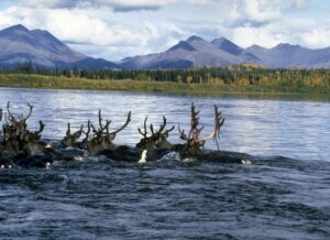
Caribou swimming across the Kobuk river in the Koubuk Valley. Photo courtesy of NPS.
Add to all that the nonstop pressure of industrialization. Not far from the Salmon River, the Ambler road poses major concerns for the waterways within the Kobuk, Koyukuk, and Yukon river watersheds.
The 211-mile industrial road would cross hundreds of streams and rivers to get to proposed mines.
Road construction, stream crossings, and increased industrial activity could increase sediment in waterways, weaken permafrost, alter natural drainage patterns, and create new pathways for pollutants to enter waterways.
These disturbances would also impact the migration patterns and habitat of the Western Arctic Caribou Herd, as well as salmon and sheefish populations found in the Kobuk River watershed.
Further south, the Susitna River faces a similar challenge.
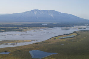
The Susitna flats and Susitna River mouth. Photo by J Schoen.
Flowing from the Alaska Range to Cook Inlet, the Susitna is one of Southcentral Alaska’s most incredible rivers. The proposed West Susitna Industrial Access Road, a state-funded corridor stretching more than 100 miles, would carve through the heart of this watershed, crossing roughly 180 streams along its route.
The road would open the region to hard rock mining, coal mining, and other extractive projects.
The construction of the road and increased extractive industry in the area would affect fish habitat, wildlife migrations, hunting and fishing grounds, and the subsistence traditions of Alaska Native communities whose lives remain closely tied to the river.
Nothing exists in isolation. A drop of water that begins as snow high up in the alpine, eventually reaches villages, wetlands, tributaries, and the sea. Along the way, rivers gather traces of every place they pass by and through, shaping and being shaped by the landscapes and communities along the way.
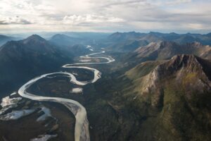
The Alatna River winds its way through a long valley in Gates of the Arctic National Park and Preserve. NPS photo by Sean Tevebaugh
What happens upstream never stays upstream. Whatever happens to rivers carries in its current and seeps into the soil, our food, our bodies. The same flow that delivers life, also carries the consequences of our actions downstream and back.
To protect rivers means protecting that essential flow.