A trip to the South Brooks Range makes the Ambler road threat palpable
By Suzanne Bostrom, senior staff attorney with Trustees
As an environmental lawyer, I rarely get to visit the places we work to protect or to see first-hand how projects might impact the landscape. I’ve worked nearly ten years fighting to stop the proposed Ambler Road yet have seen little of the area that would be forever altered by this short-sighted project with huge and harmful impacts.
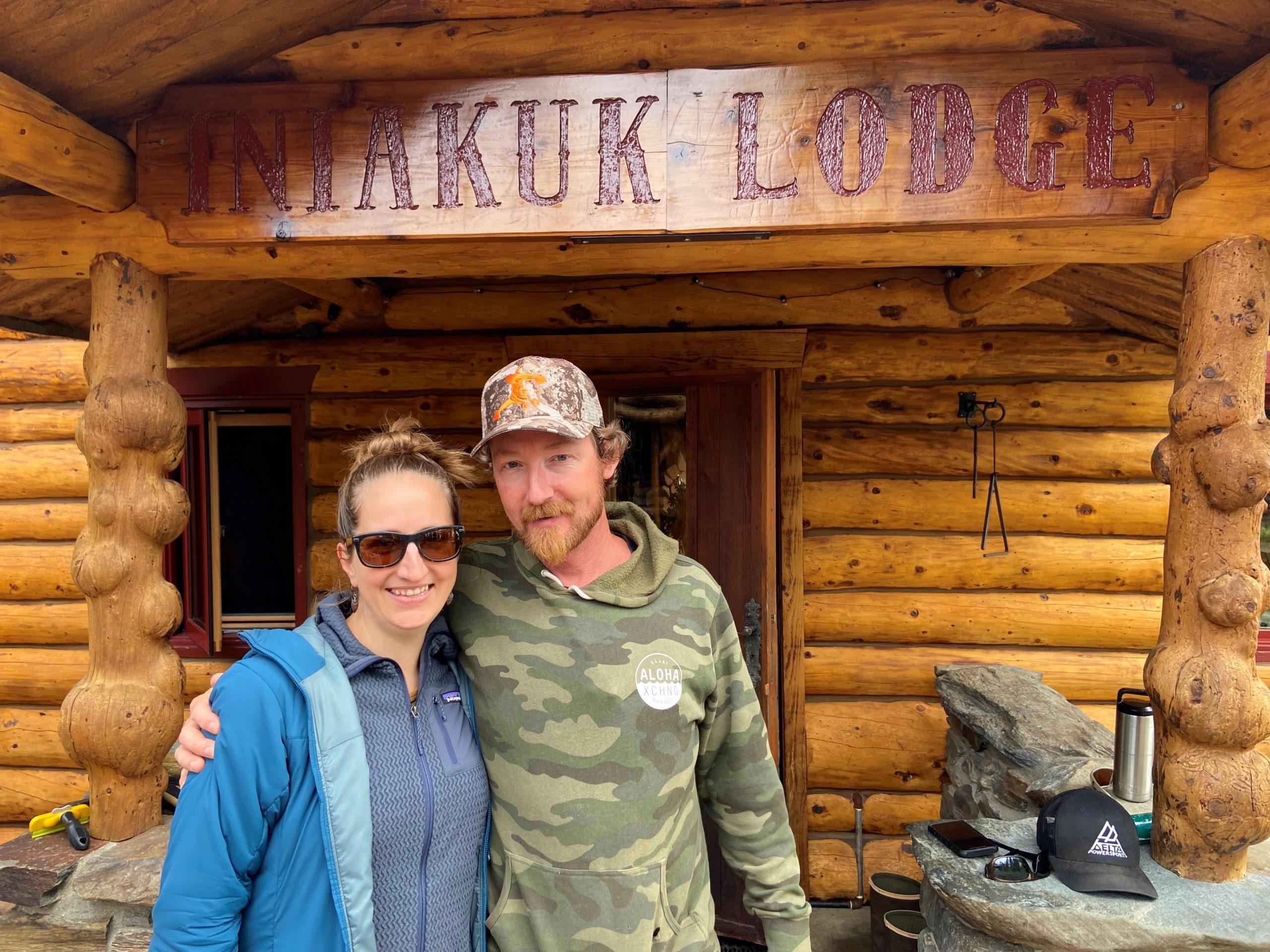
That changed last month when I got the chance to go to the Southern Brooks Range, across part of the proposed road route, to Iniakuk Lake Lodge to meet with some of the folks working with us to stop the Ambler road project.
John Gaedeke and his family own the lodge and have fought for years now to stop the Alaska Industrial Development and Export Authority from building the road. John is the chairperson of the Brooks Range Council, a group dedicated to protecting the region. He wrote about what the Ambler road project would do to the region in the Washington Post.
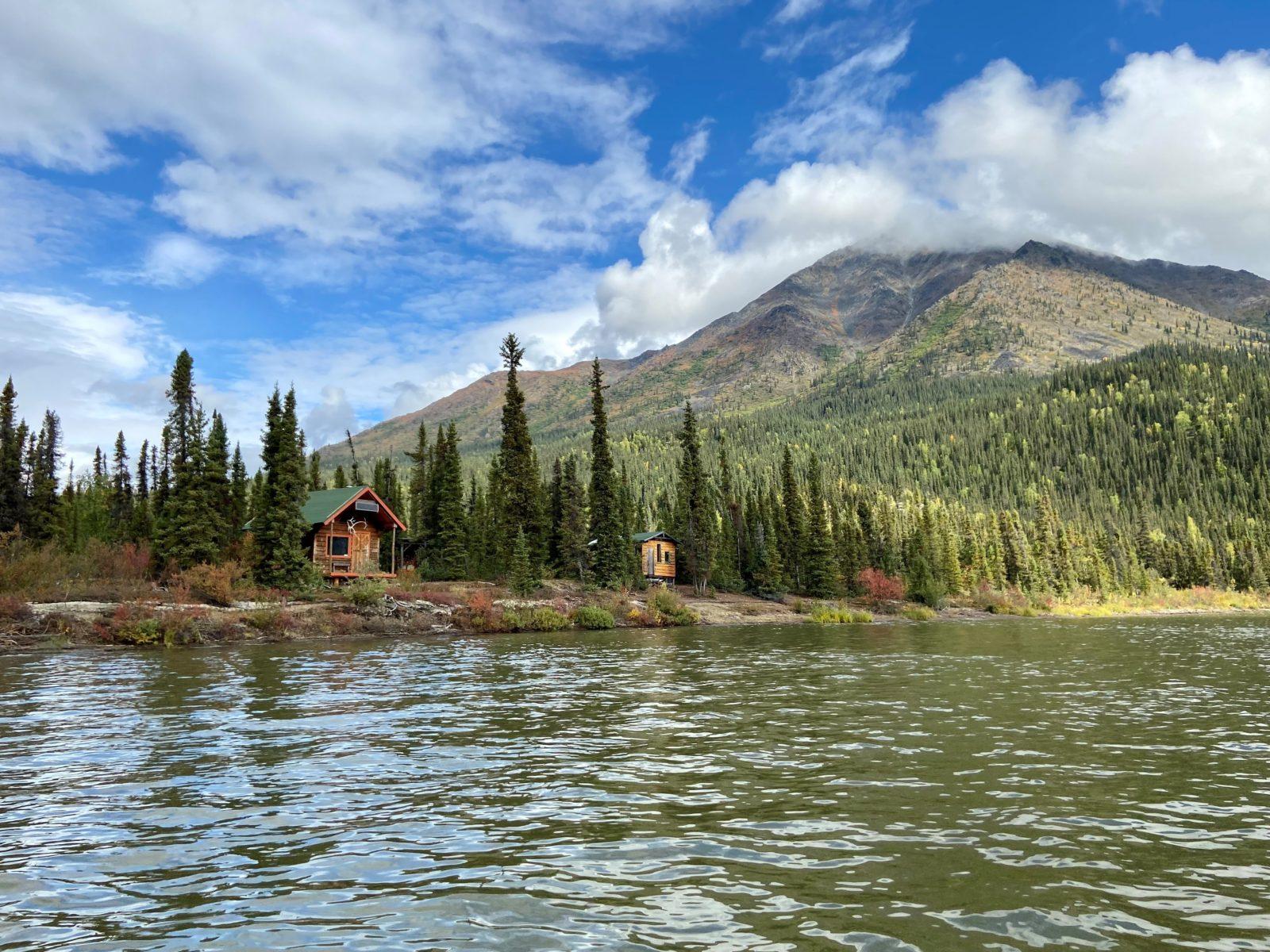
The proposed Ambler road would extend 211 miles from the Dalton Highway across the Southern Brooks Range and Gates of the Arctic National Preserve to subsidize the profit interests of Outside mining companies. The road would run just south of Iniakuk Lake, at the opposite end of the lake from the Gaedeke’s lodge.
A complex of waterways
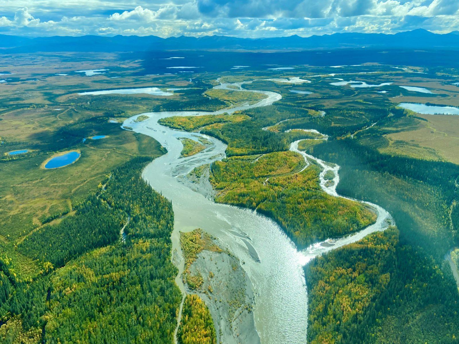
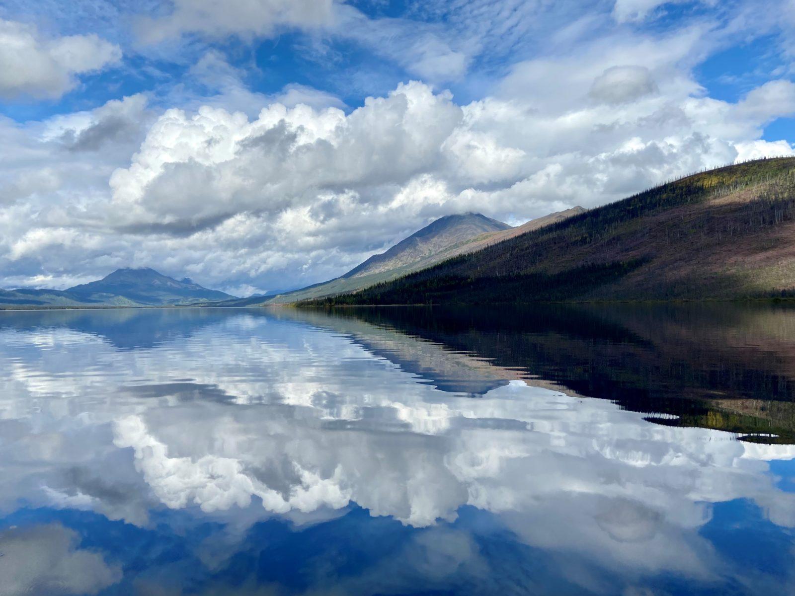
One of the things that most struck me in flying across the road route was just how complex the waterways are across the Southern Brooks Range. Waters flow down off the mountains of the Brooks Range and crisscross the vast valleys down below. In just the distance between Coldfoot and Iniakuk Lake, we flew over countless winding rivers, streams, and lakes.
The permafrost in this area is also increasingly vulnerable from the effects of climate change. I can’t imagine a worse or more damaging place to put a road.
During the flight, we also saw a mining exploration camp where a company was already actively staking out mining claims in the vicinity of the proposed road — an ominous sign of what’s to come if this project were to move forward.
It was also clear to me just how dramatically the level of industrial activity would change the nature of this entire region. When at Iniakuk Lake, you can hear planes from miles away, even without seeing them; the peace and quiet of the area is striking.
The road is slated to be a private road for mining companies, but that will still involve hundreds of massive industrial trucks carrying ore and other supplies back and forth to the mine daily — forever shattering the tranquility of this beautiful region.
Where my legal work fits in
Trustees filed a lawsuit back in 2020 challenging the Department of the Interior’s and the Army Corps of Engineers’ decisions approving the project permits and rights-of-way. One of the key issues in our litigation was that the agencies, particularly the Corps of Engineers, didn’t have enough information about fish, aquatic resources, or the design of the project to ensure there wouldn’t be significant impacts to the waters across the Southern Brooks Range.
The project itself would cross roughly 2,900 streams and 11 major rivers, including the Kobuk River (a designated Wild & Scenic River) and would permanently fill over 2,000 acres of wetlands. This project would be one of the largest and most damaging projects seen in our state in decades, all for the sake of foreign mining interests who want to exploit the region for short-term financial gain.
How you can engage now
Earlier this year, the Department of the Interior acknowledged there were legal problems with their analysis of the subsistence impacts for the project, including with their consideration of impacts to fish, water, and caribou.
Interior says it will address those problems in a Supplemental Environmental Impact Statement. Trustees and our partners will be engaged in that process, and there will also be opportunities for the public to give input.
The first of those opportunities for the public to weigh in just started, with the Bureau of Land Management accepting comments through November 4. Find more information about how to comment on BLM’s website.
I hope you will join us in speaking out against this damaging project and in favor of protecting the Southern Brooks Range and all that lives and exists there.