Eastern Interior Plan Protects Important Areas

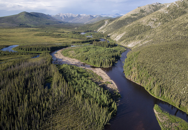
The new BLM Eastern Interior plan includes the beautiful White Mountains National Recreational Area. BLM photo.
In late July, the Bureau of Land Management (BLM) took a great step forward for Alaska and all those that use and rely on the BLM lands in the Eastern Interior Planning Area. The area—6.7 million acres of some of Alaska’s most remote and pristine public land—extends from Fairbanks east to the U.S.-Canadian border, and runs from Tok north to Fort Yukon and the Yukon River. The area includes the White Mountains National Recreation Area, the Steese National Conservation Area, the Fortymile Wild and Scenic River, and the Upper Draanjik River (also known as the Black River).
BLM has been working on this plan for several years. In 2012, the agency released a draft. But that draft failed to protect important lands and resources, and considered opening the White Mountains—Fairbanks’ “back yard”—to mining. Thousands spoke out in support of greater conservation measures and the need to protect subsistence resources.
Thankfully, BLM listened. The proposed final plan protects important natural areas and cultural values. The Eastern Interior plan protects traditional land uses and habitat important for moose, caribou and other wildlife critical for subsistence use. The decision has been well-received by many that sought stronger protections for important areas.
Trustees for Alaska has been working on BLM land-management issues for over a decade, assisting conservation organizations and tribal interests with BLM’s efforts to revise management plans for all of the BLM units across the State. Each plan revision comes with its own set of issues, but at the root, each management plan needs to protect the natural resources and values that the public enjoys on these public lands.
The BLM expects to release a final decision on the proposed Eastern Interior plan in December 2016.


