Protecting Alaska’s Western Arctic
Trustees for Alaska has a rich history of working to protect the wild places and resources of the National Petroleum Reserve–Alaska (Reserve). At 23 million acres—roughly the size of Indiana—the Reserve is the largest single unit of public land in the country. The Reserve stretches across the Western Arctic, bordering the Chukchi and Beaufort Seas to the north and the foothills of the Brooks Range to the south. Much of the eastern border of the Reserve traces the Colville River and its Delta, which drains over 30% of the North Slope.
Exceptional Ecological Values
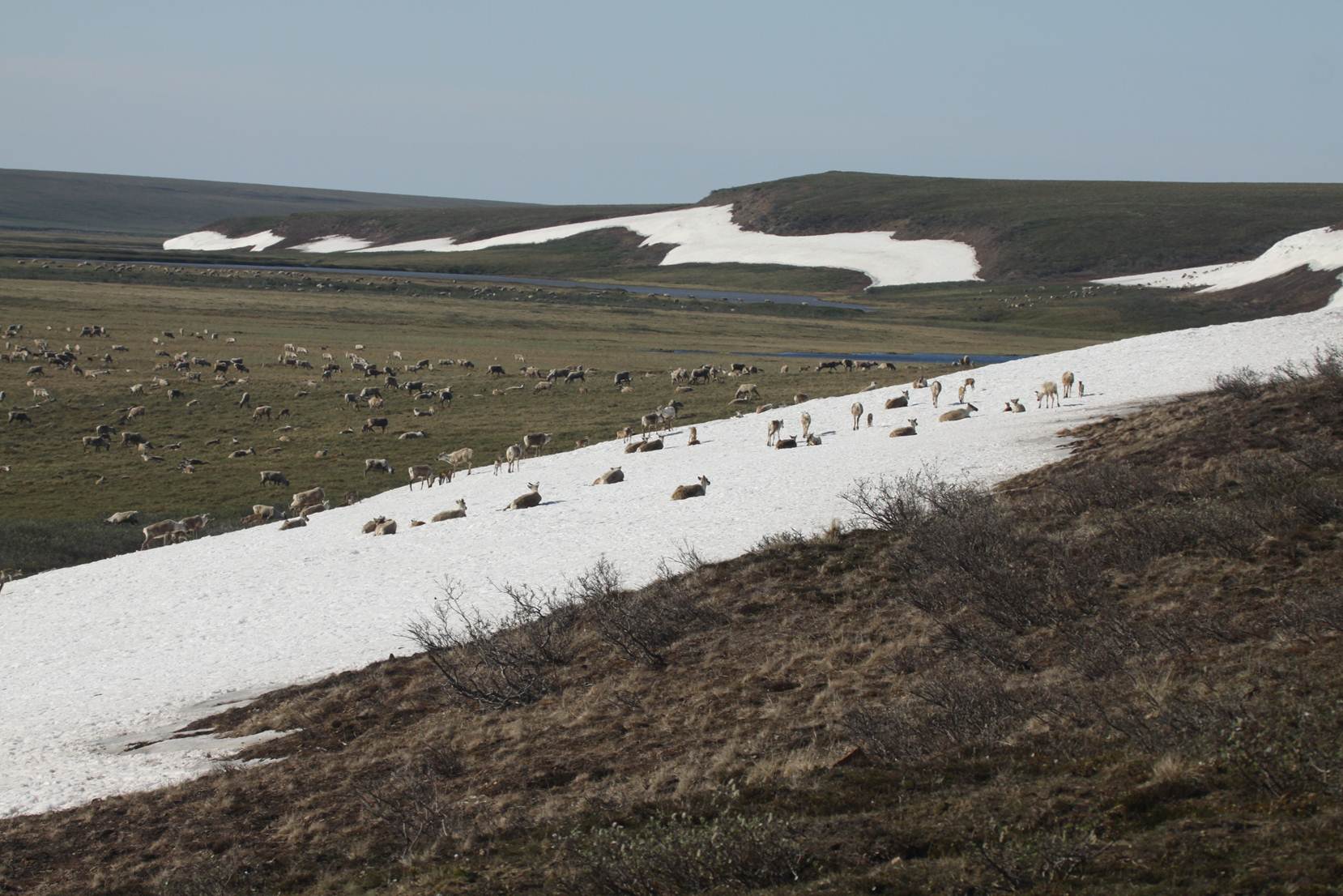
The Western Arctic Caribou Herd reside part of the year inside the National Petroleum Reserve-Alaska. Photo by Bob Childers.
Mostly undeveloped, the Reserve provides rich habitat for caribou, grizzly and polar bears, wolves, and a wide range of migratory birds. Birds from the Pacific, Central, Mississippi, and Atlantic Flyways, and from as far away as the southern tip of Chile and the islands of the South Pacific, journey to the Reserve to rear their chicks in its rich mosaic of coastal wetlands. The Western Arctic and Teshekpuk Lake caribou herds use the Reserve for calving, insect relief, and migration corridors. The Western Arctic Caribou Herd, which numbers over 235,000, is one of the three largest in North America, and is an important subsistence resource to over 40 communities in northwestern Alaska. The Reserve also provides key coastal habitat in areas such as Kasegaluk Lagoon and Peard Bay, to support seals, beluga whales, walrus, and migratory birds. The Colville River and its Delta provide important habitat for gyrfalcon, prairie falcon, red-tailed hawks, and golden eagles.
Special Areas
President Warren G. Harding originally set aside the Reserve in 1923 as a petroleum reserve for the U.S. Navy. In 1976, it was re-designated and Congress passed a new law recognizing the exceptional ecological values in the Reserve. The new law instructed the Secretary of the Interior to designate any areas containing significant subsistence, recreational, fish and wildlife, or historical or scenic values. Based on this authority, the Secretary designated three Special Areas—the Teshekpuk Lake, Colville River, and Utukok River Uplands Special Areas—to ensure “maximum protection” of the environment, fish and wildlife, and historical or scenic values.
BLM’s Plan
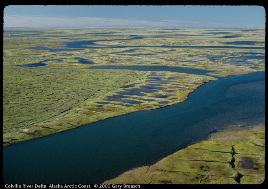
Aerial view of the Colville River Delta on Alaska’s Arctic Coast. Photo by (c) Gary Braasch.
In early 2013, the Bureau of Land Management finalized the first-ever comprehensive management plan for the Reserve. This Integrated Activity Plan (Plan) expanded some of the existing Special Areas, designated new ones, and made large parts of the Special Areas, totaling 11-million acres, off limits to oil and gas leasing. The expanded Teshekpuk Lake and Utukok Uplands, the new Peard Bay, Kasegaluk Lagoon, and the expanded purposes of Colville River Special Areas ensure that some of the most critical areas within the Reserve will be protected from oil and gas drilling. For example, the Teshekpuk Lake Special Area encompasses some of the most significant migratory bird habitat in the Arctic, contains critical calving grounds for the Teshekpuk Lake caribou herd, and provides vitally important subsistence hunting and fishing grounds. While the Plan protects many of the wildlife, habitat, and subsistence values of the Reserve, over half of the Reserve is still available for oil and gas development and parts of the Special Areas are still open to oil and gas activities and infrastructure development.
Trustees’ Work
Trustees recently represented five individuals from Nuiqsut—the community closest to oil and gas development in the Reserve—who depend on the lands surrounding their village for subsistence hunting and fishing. Oil development near their community is threatening their subsistence way of life and the biologically rich Colville River Delta. The individuals challenged the U.S. Army Corps of Engineers’ decision to allow ConocoPhillips to place a road, bridges, and other oil and gas infrastructure in the heart of one of their most important subsistence hunting and fishing areas. Here’s background about the case, and case updates can be found here and here.
Conoco is now trying to move forward with additional development further west in the Greater Mooses Tooth unit.
Trustees and our partners will continue to work to protect the Special Areas and wildlife resources of the Reserve in the face of increased energy development and the escalating impacts from climate change.